Professional Land Surveying Services
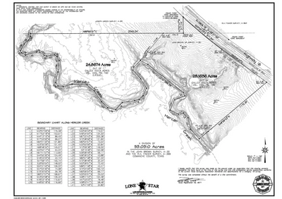
Topographic Surveys
Our topographic surveys provide detailed information about the contours and features of your property. This is essential for construction, engineering, and land development projects.
Boundary Surveys
Our boundary surveys use state-of-the-art technology to accurately determine the boundaries of your property. We provide detailed reports that can be used for legal purposes and to resolve boundary disputes.
Construction Layout
Our construction layout services ensure that your project is built to the correct specifications and within the boundaries of your property. We work closely with contractors and engineers to provide accurate and reliable staking services.
Land Title Surveys
Our land title surveys provide a comprehensive analysis of your property, including boundary lines, easements, encroachments, and other important information. This is essential for real estate transactions and resolving boundary disputes.
ALTA/NSPS Surveys
Our ALTA/NSPS surveys provide detailed information about your property, including boundary lines, improvements, and other important features. This is essential for commercial real estate transactions and can help you make informed decisions about your property.
Expert Witness Testimony
Our experienced surveyors can provide expert witness testimony in legal proceedings related to land surveying. We have extensive knowledge of the industry and can provide valuable insights and analysis to support your case.
About Us

Company Overview
Lone Star Land Surveying and Mapping has been dedicated to providing quality surveying and mapping services for over 20 years. We strive to produce a top quality product while targeting a high level of customer service. Our goal is to maintain the highest levels of professionalism, integrity, honesty and fairness in our relationships with our professional associates and customers.

Full List of Professional Services
Subdivision Platting
Title Surveying
Topographic Surveying
Boundary Surveying
Elevation Certificates
GPS Surveying
Construction Layout
Volume Calculations
As-Builts/Final Surveys
LiDar Drone Services
Photogrammetry Drone Services
3D Scanning
Contact Information
Jarrod Antley, RPLS
936-522-8716
or email: jarrod.antley@gmail.com
Layci Magouirk, Office Manager
936-522-6811
Jonathan Magouirk, Survey Technician
936-320-1990


